A MAP THAT HAS BECOME ONE OF THE MOST ICONIC EXAMPLES OF MODERN CARTOGRAPHY

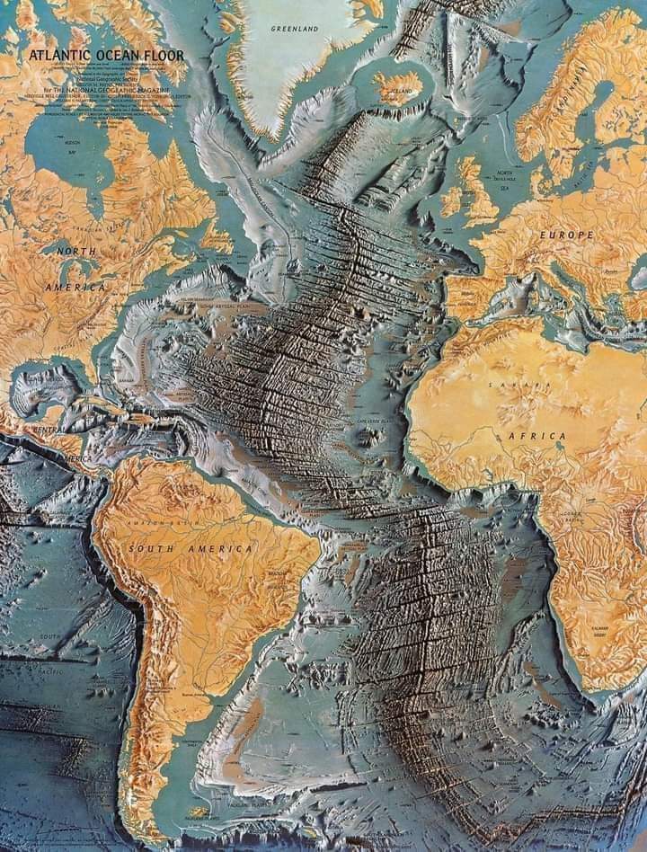
In 1968, *National Geographic* published a map that has become one of the most iconic examples of modern cartography: a painted landscape by Austrian artist Heinrich Berann. This map drew attention not only for its cartographic accuracy but also for its remarkable artistic quality.
Heinrich Berann, renowned for his skill in creating pictorial maps, combined his artistic prowess with advanced cartographic techniques to produce a map that was both a work of art and an informative tool. The map in question depicted the Himalayas, an area Berann approached with a unique and detailed vision.
Creating this map involved meticulous research and observation. Berann utilized aerial photographs and other geospatial data to ensure that the topographic representations were accurate. He then translated this information into a visually stunning format, where geography was portrayed with unusual clarity and depth for the time.
The result was a map that was not only useful to geographers and explorers but also captured the majesty and drama of the mountainous landscape. The details of peaks, valleys, and glaciers were represented with near-photographic precision, while the color palette used provided a sense of depth and texture.
Berann\'s work reflected the growing importance of artistic cartography in visualizing geographic data. His innovative approach not only helped *National Geographic* present information in an engaging manner but also set a new standard in creating topographic maps.
The impact of Heinrich Berann\'s painted map was significant, and its legacy continues to influence the way maps are created and perceived today. His ability to merge art and science left an indelible mark on the field of cartography and remains a standout example of how precision and aesthetics can combine to create an impressive visual representation of the natural world.
